Current Major Projects
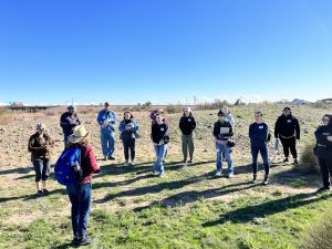
Archaeological Field School at S’eḏav Va’aki (Pueblo Grande) with the City of Phoenix
Project Co-Leads: Matthew Peeples, Matthew Kroot, and the City of Phoenix Archaeology Office
Supported by the ASU Center for Archaeology and Society with a public lecture series supported by the Arizona Humanities Council
This field project and associated field school are organized in collaboration with the City of Phoenix, the Office of the City Archaeologist (Laurene Montero 2023 and Christopher Schwartz 2025), and the S’edav Va’aki Museum. The project focuses on documenting and researching archaeological resources within a portion of the Ancestral O’Odham site of S’eḏav Va’aki (Pueblo Grande), and on developing recommendations for its long-term management on behalf of the City of Phoenix. The field school operates under a project-specific Arizona Antiquities Act permit issued by the Arizona State Museum.
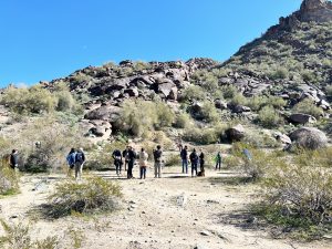
In addition to supporting the City of Phoenix’s cultural resource management goals, the field school is designed to introduce students to archaeological field research, analysis, consultation, permitting and legal processes, curation, archiving, and reporting. The curriculum integrates lectures, discussions, workshops, site tours, field and laboratory sessions, and student presentations. These components provide students with both a broad understanding of archaeological practice and practical experience relevant to cultural resource management and related careers.
Students also engage directly in the tribal consultation process and examine the legal and ethical contexts of conducting archaeological research in partnership with Indigenous communities. As part of the course, they participate in meetings and discussions with representatives from the Tribal Historic Preservation Offices of the Salt River Pima-Maricopa Indian Community and the Gila River Indian Community, as well as with officials from state and federal agencies. These experiences provide students with firsthand insight into the consultation process and the responsibilities it entails.
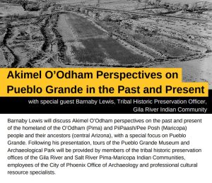
The project includes a public-facing component funded by the Arizona Humanities Council in partnership with the Friends of Pueblo Grande Museum. This outreach effort features public events, lectures, and receptions centered on tribal consultation, careers in archaeology, and Akimel O’Odham perspectives on the Phoenix area.
Human Networks, Sustainable Development, and Lived Experience in a Nonindustrial Society
PI: Scott Ortman (University of Colorado Boulder), Co-PIs: Keith Kintigh (Arizona State University), Allen Lee (Arizona State University), Matthew Peeples, Barbara J Mills (University of Arizona), Ann Stodder (Office of Archaeological Studies, University of New Mexico), Kyle Bocinsky (University of Montana), William Doelle (Archaeology Southwest)
Funded by NSF Human Networks and Data Science Research (HNDS-R) program
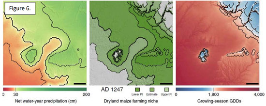
This project investigates how patterns of connection between people affect their quality of life over the long term. The goal is to map out patterns of interaction between people in different locations and assess how these patterns impacted the development of their communities in a changing environment. Learning about these patterns can be accomplished with archaeological data, which show how ancient people worked together to meet basic human needs. Understanding how social networks grew and changed in the past can lead to a better understanding of how people today can work together for increased prosperity, inclusiveness, environmental sustainability, and peace.
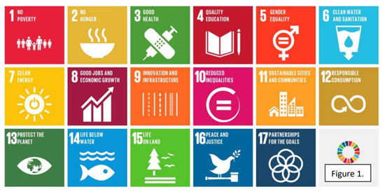
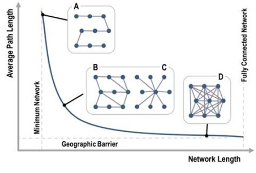
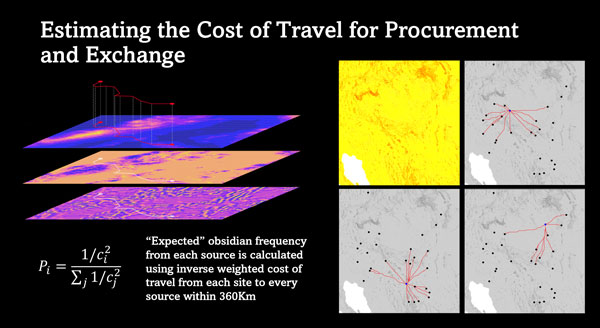
This project brings together a team of researchers from multiple universities, not-for-profit organizations, and tribal communities. These scientists use archaeological evidence to investigate relationships between spatial patterns of social interaction and the quality of life over 800 years in the southwestern United States. They combine demographic, socioeconomic, health, and environmental reconstructions of the past built using data from previous NSF-funded projects into a single research platform. They also use this platform, together with ideas from complex systems and network analysis, to examine how spatial properties of human networks influenced other aspects of human development, using archaeological indicators of the UN Sustainable Development Goals as the basis for assessment. The results will advance understandings of how socio-spatial networks influence sustainability and the quality of life.
From Households to Landscapes: Cyberinfrastructure for Interdisciplinary Research in the Ancient American Southwest
Co-PIs: Jeffery J. Clark (Archaeology Southwest), Barbra J. Mills (University of Arizona), Matthew A. Peeples, and Scott Ortman (University of Colorado Boulder)
Funded by NSF Human Networks and Data Science Infrastructure Program (HNDS-I)
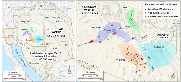
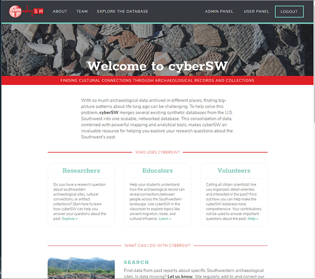
The cyberSW platform is an online gateway to archaeological knowledge. Free to anyone with Internet, cyberSW opens the way for big-picture research on the ancient American Southwest. To date, it contains data on 25,000 Indigenous villages, including pottery, stone tools, room counts, and public buildings at those villages. This grant will expand the structure of cyberSW to include data on individual households within some of these villages, using information similar to that collected by the US Census. The US Census collects information such as wealth, cultural background, and number of people from a particular address or neighborhood. This project will collect similar data from ancient households and neighborhoods using the artifacts and architecture they left behind. In addition, links between households, neighborhoods and settlements will be explored through time. Because cyberSW currently provides data only about settlements, expanding the database to include households and neighborhoods within settlements will allow new research on how Indigenous peoples lived before the Spanish arrived.
Under the guidance of Tribal members, cyberSW will be expanded to include information about rooms, trash deposits, and other household features. This will make it easier to study how households and their networks changed over long periods of time. The project will develop a variety of network analyses and metrics from household architecture and associated artifacts, and make these analyses and metrics available through the online science gateway. This gateway will include a chronology tool that dates and groups artifacts and households to reconstruct neighborhoods and networks at different points in time. Using this interface and other tools, scientists, Tribal members, and the public will be able to explore ancient Indigenous settlements without compromising actual site locations. People will gain insight into the different social groups who lived in these villages. They will also be able to explore how households and villages interacted with one another. Importantly, it will be possible to download data in formats and at scales useful for other kinds of research. This will make cyberSW a great tool for geographers and other scientists who use census data to study households. It will also encourage researchers to cross disciplines and work together to learn about the past, present, and future of households. Finally, cyberSW will serve as a model for large archaeological databases across the world.
cyberSW: A Data Synthesis and Knowledge Discovery System for Long-term Interdisciplinary Research on Southwest Social Change
PI: Barbara J. Mills (University of Arizona), Co-PIs: Sudha Ram (University of Arizona), Matthew Peeples (ASU), Jeffery Clark (Archaeology Southwest), Scott Ortman (University of Colorado Boulder)
Funded by NSF Resource Implementation for Data Intensive Research (RIDIR) program
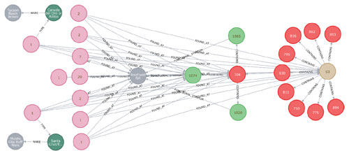
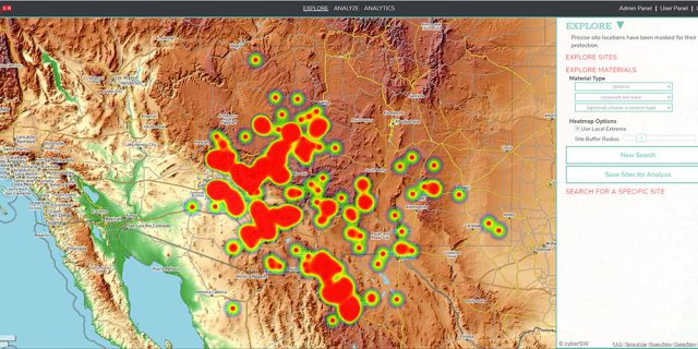
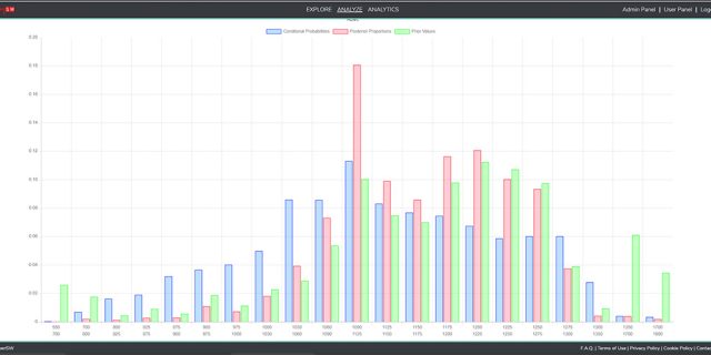
The cyberSW project, funded by the National Science Foundation Resource Implementation for Data Intensive Research (RIDIR) program, is focused on developing an analytical infrastructure for comparative social science research using archaeological data. We envision cyberSW as an integrated knowledge discovery system that will significantly enhance interdisciplinary research on long-term social change at decadal to centennial scales. The project has resulted in the integration data on millions of objects from tens of thousands of Prehispanic settlements across the U.S. Southwest and Mexican Northwest, making it one of the largest digital archaeological repositories in the world (and it continues to grow). CyberSW uses the Neo4j graph database system along with custom designed open source tools to help researchers quickly and easily obtain, analyze, and visualize archaeological data.
CyberSW is now live! Click here to learn more and to start exploring!
HNDS-I: CatMapper: User-friendly tools for integrating data by complex, dynamic categories
PI; Daniel Hruschka
Co-PIs: Sharon Hsiao, Matthew Peeples
Project Team: Robert Bischoff, Cindy Huang, Harsha Kasi
Scientists and policymakers often bring together data from many different sources to study pressing social issues (e.g., economic change, migration, war, political movements, and health and well-being). However, bringing together data from different datasets is challenging when datasets use different labels for the same thing or use the same label for different things. CatMapper is an online application that helps users overcome the challenge of translating across datasets. With CatMapper’s tools, users can unlock and combine data in new ways to answer pressing social questions. This project creates a version of CatMapper that includes user-tested online tools and builds a community of users who can benefit from them. The project also provides educational and research opportunities for students.
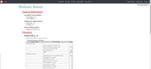
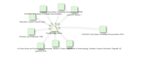
CatMapper consists of two applications that are used to connect categories often used in the social sciences. SocioMap focuses on thousands of categories for ethnicities, languages, religions, and administrative districts. ArchaMap focuses on thousands of categories used for material artifacts and sites in archaeology. To help link datasets together, CatMapper provides four sets of tools to: (1) explore information about specific categories, (2) translate categories across datasets, (3) bring together datasets in new ways, and (4) store and share translations of and merges between different datasets for use by others. CatMapper includes self-guided tutorials for researchers, students, and other interested members of the public wishing to learn how to connect data across diverse data streams to answer scientific questions. CatMapper is freely available to users across academia, industry, non-governmental organizations, and government institutions. It includes a user-friendly interface to facilitate analyses of population data at multiple spatial and temporal scales.

